


Les Fours

jpduc
User

Length
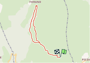
8.4 km

Max alt
1634 m

Uphill gradient
252 m
Km-Effort
11.7 km

Min alt
1443 m

Downhill gradient
252 m
Boucle
Yes
Creation date :
2018-06-26 13:37:05.021
Updated on :
2021-10-18 16:39:03.921
2h50
Difficulty : Easy

FREE GPS app for hiking
 SityTrail
IGN / Geographical institutes
SityTrail Plus
The world is yours!
About
Trail Walking of 8.4 km to be discovered at Auvergne-Rhône-Alpes, Savoy, La Plagne-Tarentaise. This trail is proposed by jpduc.
Description
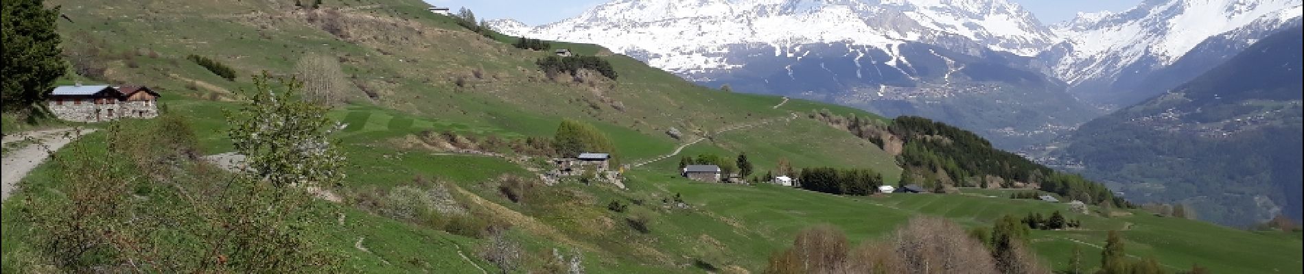
au départ de Valezan, Balade facile vers Les Fours et le long du Canal des Chapelles.
Panorama admirable et très ouvert sur les montagnes dont le Mt Pourri, La grande Casse....
Photos


Positioning
Country:
France
Region :
Auvergne-Rhône-Alpes
Department/Province :
Savoy
Municipality :
La Plagne-Tarentaise
Location:
Unknown
Start:(Dec)
Start:(UTM)
320080 ; 5050382 (32T) N.
Comments
Super rando ! Merci !
Très belle randonnée facile à faire en famille.